This procedure guides you through the settings to generate a trajectory using the node on the software’s user interface (UI). An alternative to creating a trajectory through this process is to create a trajectory using Google Earth. To learn more about individual cell settings, refer to the UI descriptions.
In the Settings Browser, click .
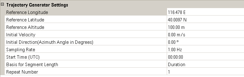
Configure
the  Trajectory
Generator Settings.
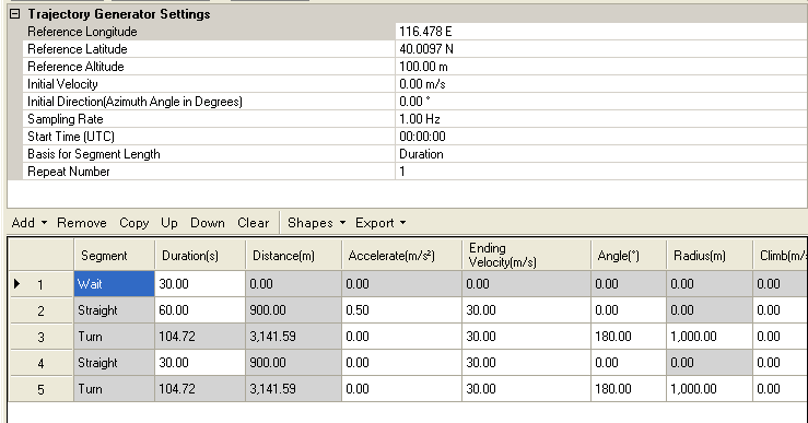
Trajectory
Generator Settings.
Create the trajectory file, using one of the following methods:
Specify each segment of the trajectory from scratch. Three types of segments are available: , , and , which covers basically all the movements required in trajectory creation. You can or a certain segment item, or an existing segment. You can also use or to adjust the order of a certain segment item. deletes all the segment items in the list. You can specify , , or through the segment edit table.
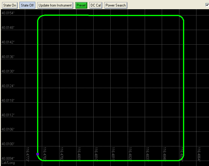
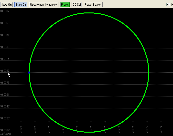
To view the shape created by the segments, click on the Trajectory Preview node. This node displays a preview of the trajectory based on the segment list configuration. The figures in the next bullet are from the Trajectory Preview node.
Use predefined to quickly create a trajectory. Two types are available:
Generate the trajectory:
To generate a trajectory file to use with the scenario generator, select and save it as an NMEA GGA file type.
To generate a trajectory file to view using Google Earth, select and save the file as one of two file types:
When a file type is selected, the dialog box appears to save the file as the selected type.
If you save a file as a Google Earth kml file type or have an existing kml file and need the same trajectory in the NMEA GGA format, you can convert it to an NMEA GGA by selecting , which launches the KML to NMEA Converter dialog box.